
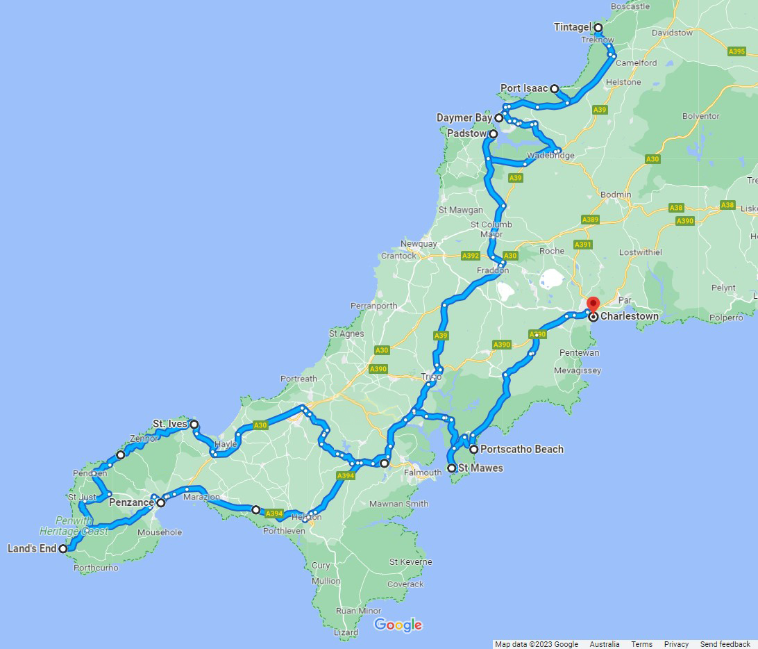
In the summer of 2023, via train, bus, car and footfall, I travelled Cornwall’s steep and narrow roads from Padstow to Penzance, and from Porthminster to Portscatho.
Here is a snapshot of some of my stopping-off points, listed in an anti-clockwise direction from Tintagel on the north coast, through Land’s End in the south-west and on to Charlestown in the south-east.
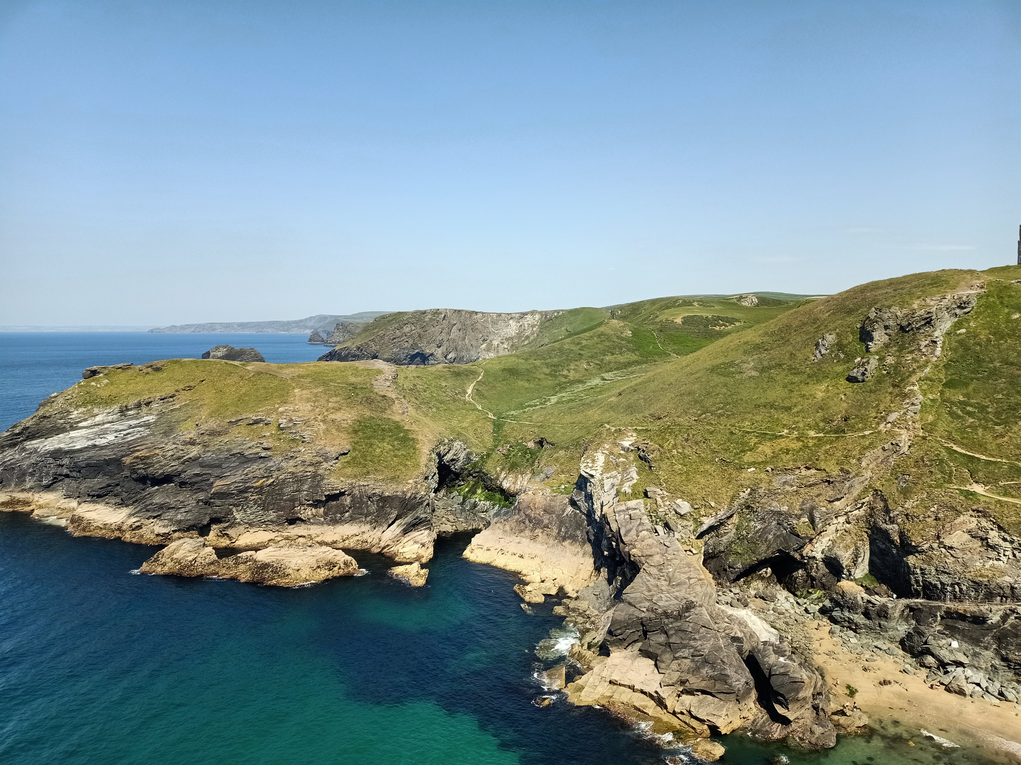
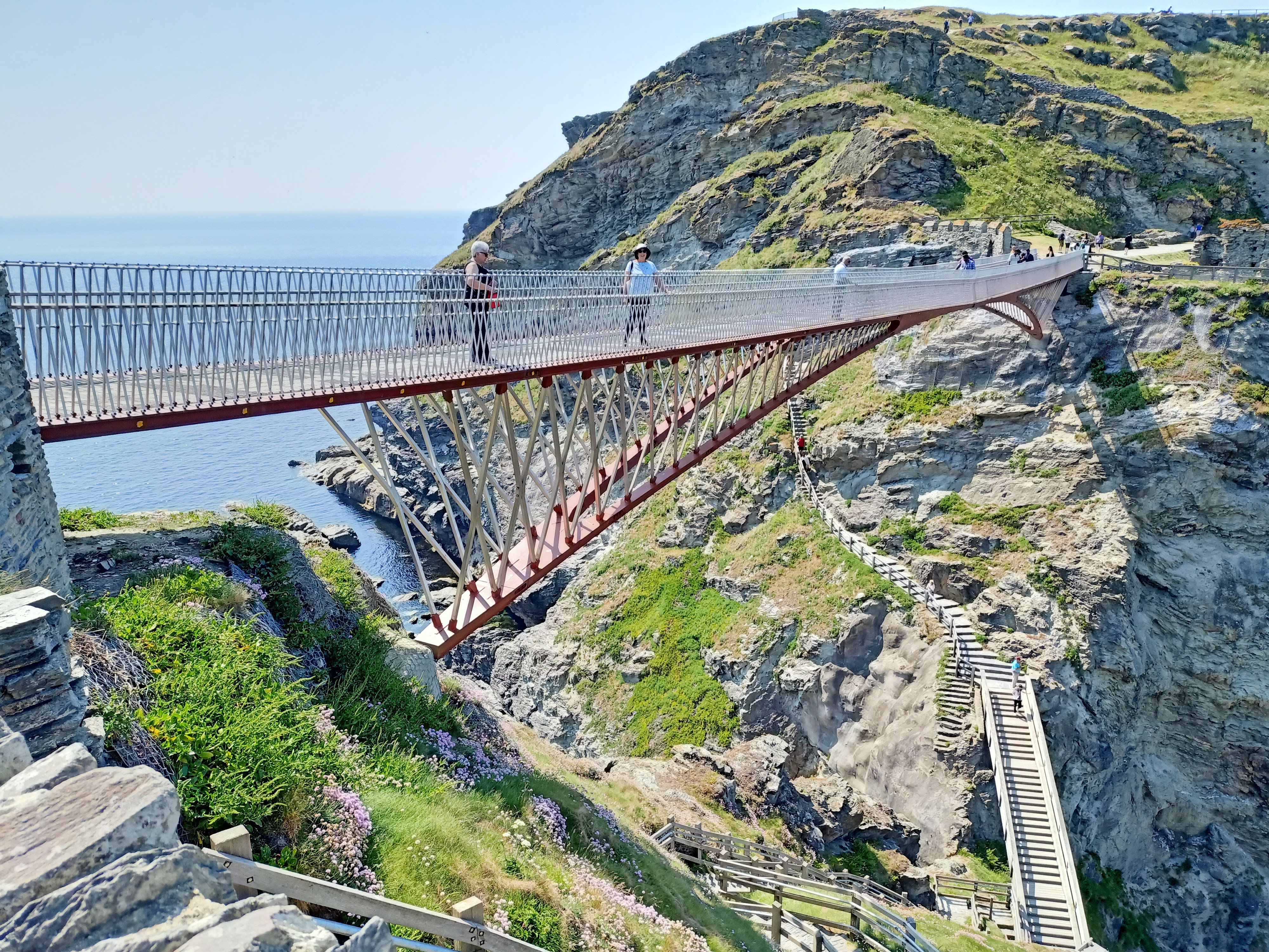
Tintagel Castle
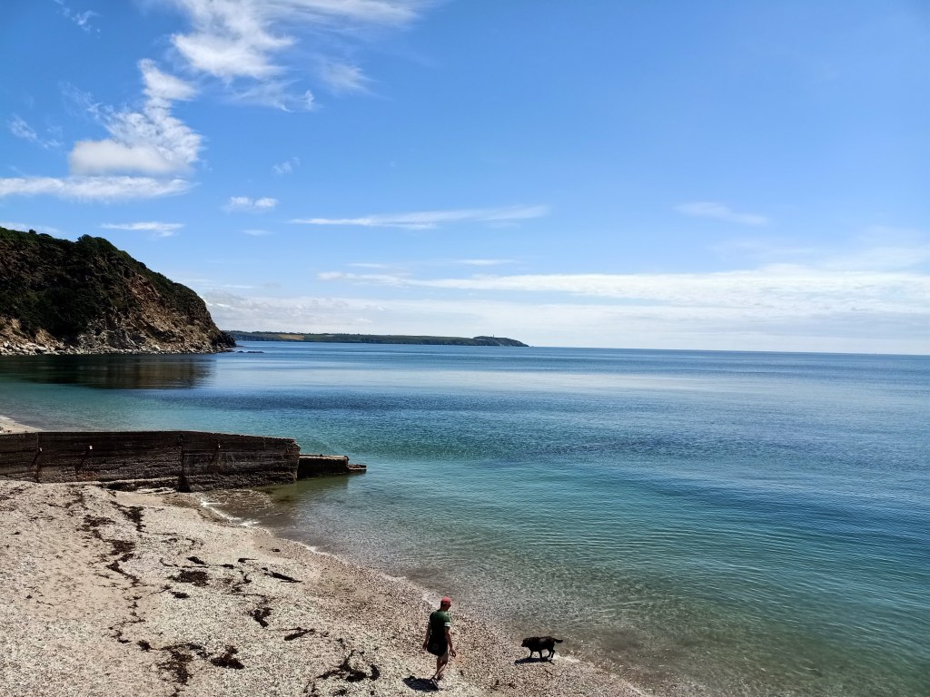
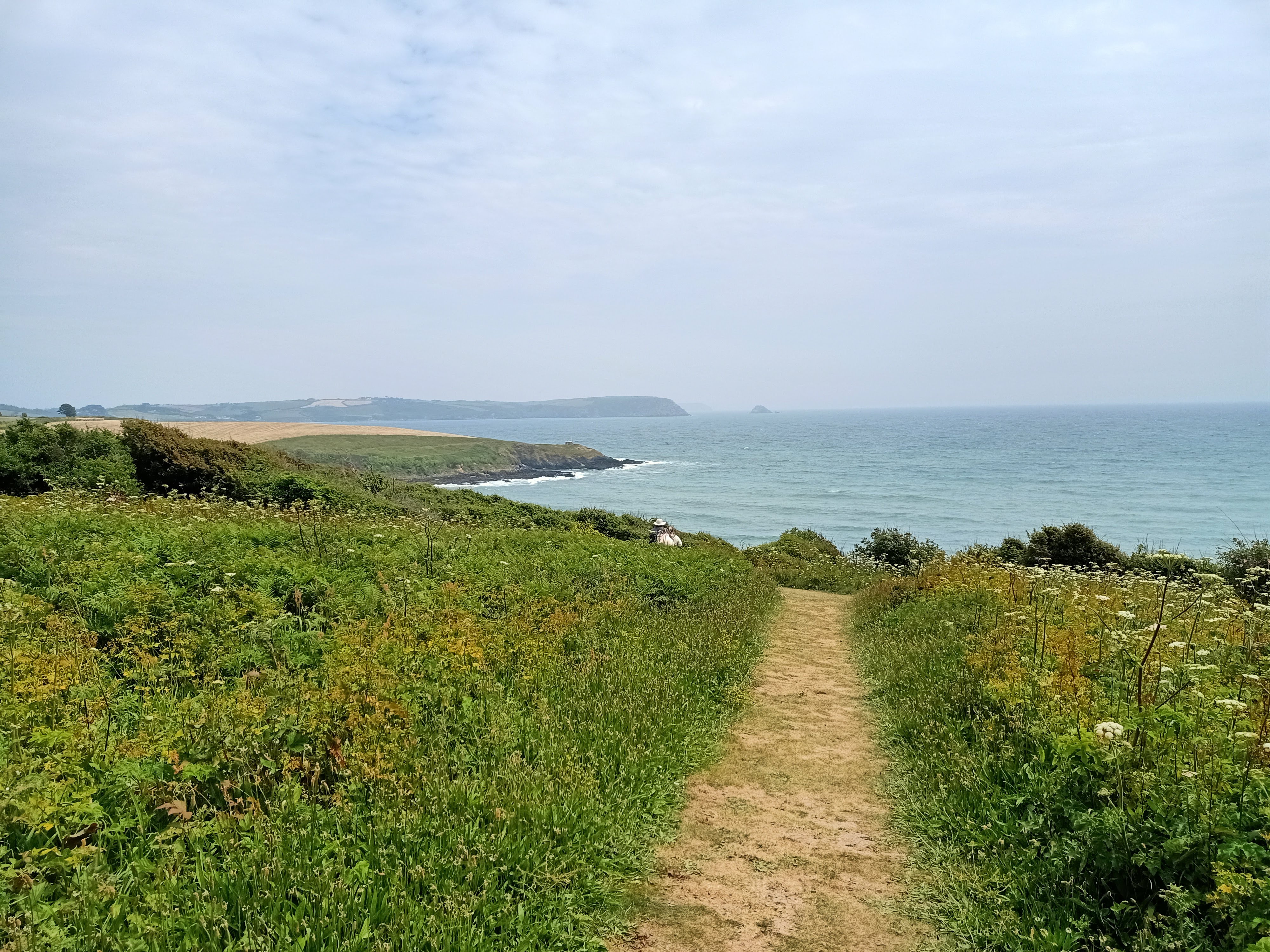
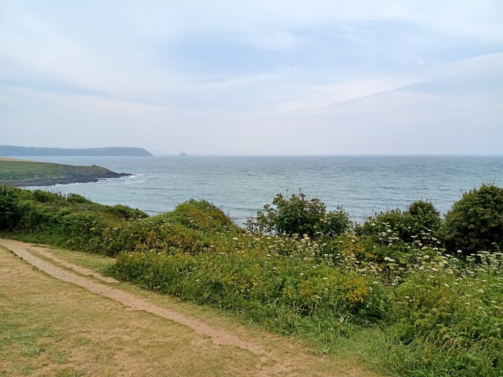
Tintagel was my first encounter with the South West Coast Path. The 1,014 km (630 mile) path begins in Somerset and ends in Dorset. In between those two points, it traverses the entire coast of Cornwall.
While the route rises and falls some 35,000 m (115,000 ft) over its full course, the National Trails website provides detailed information for those with mobility issues who might want to seek out sections with easier access.
The castle at Tintagel is an English Heritage site. Access is via a path with 140 steps or the sturdy cantilever bridge (completed in 2019).
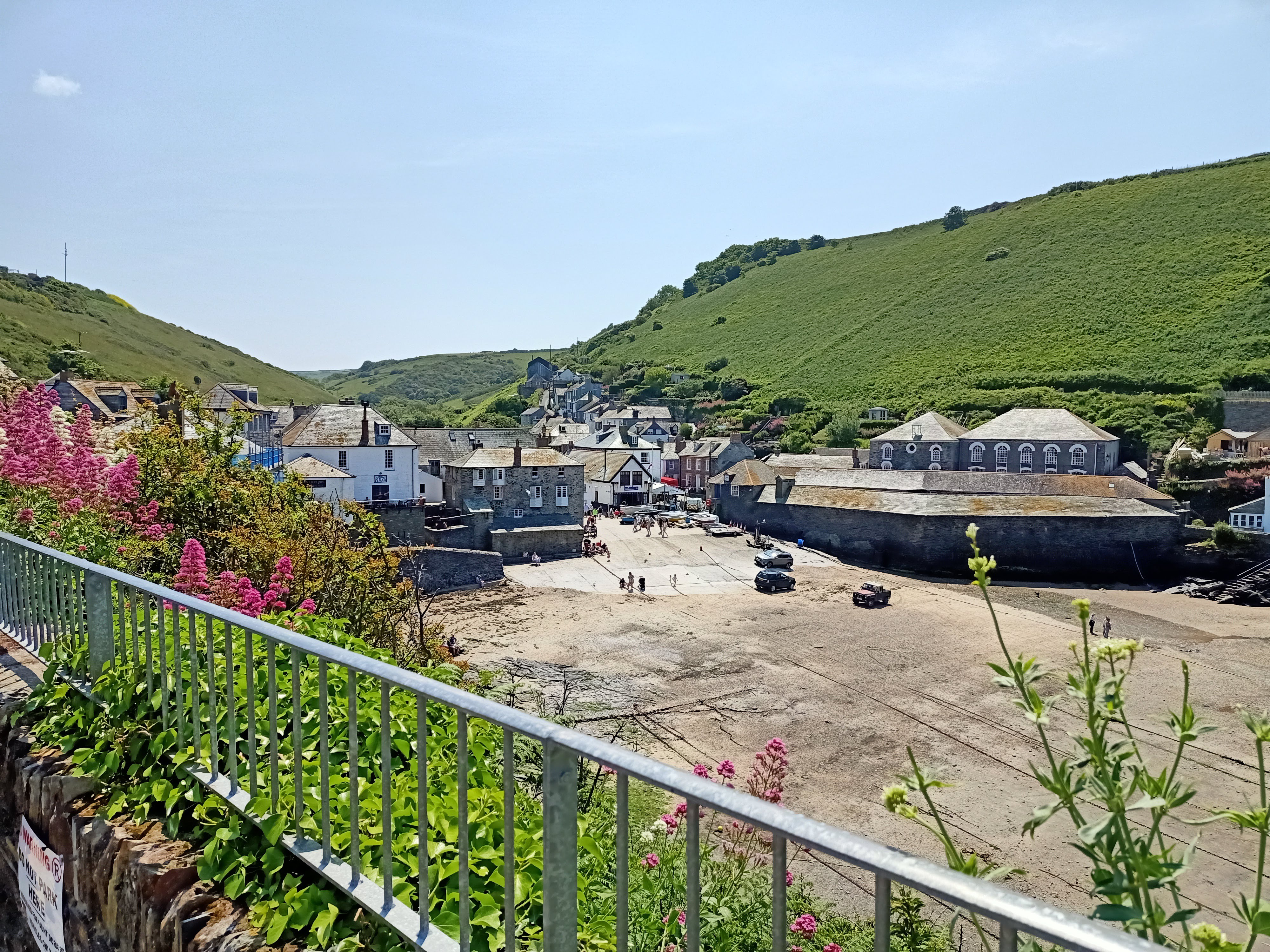
Port Isaac
The houses and harbour of Port Isaac will be familiar to viewers of the Doc Martin television series where they double as the backdrop for the show’s Port Wenn setting.
Port Isaac is crammed with whitewashed fishermen’s cottages virtually all of which are now used as holiday lets. Apparently the population in the heart of town has dwindled to 10 permanent residents.
Access to the village is via steep laneways. Don’t expect to find a parking spot near the main shopping hub. There are, however, two council-run car parks ‘up the hill’. As is often the case at stop-off points in the UK, you’ll need to pay for parking. (More parking information available via Cornwall Hideaways.)
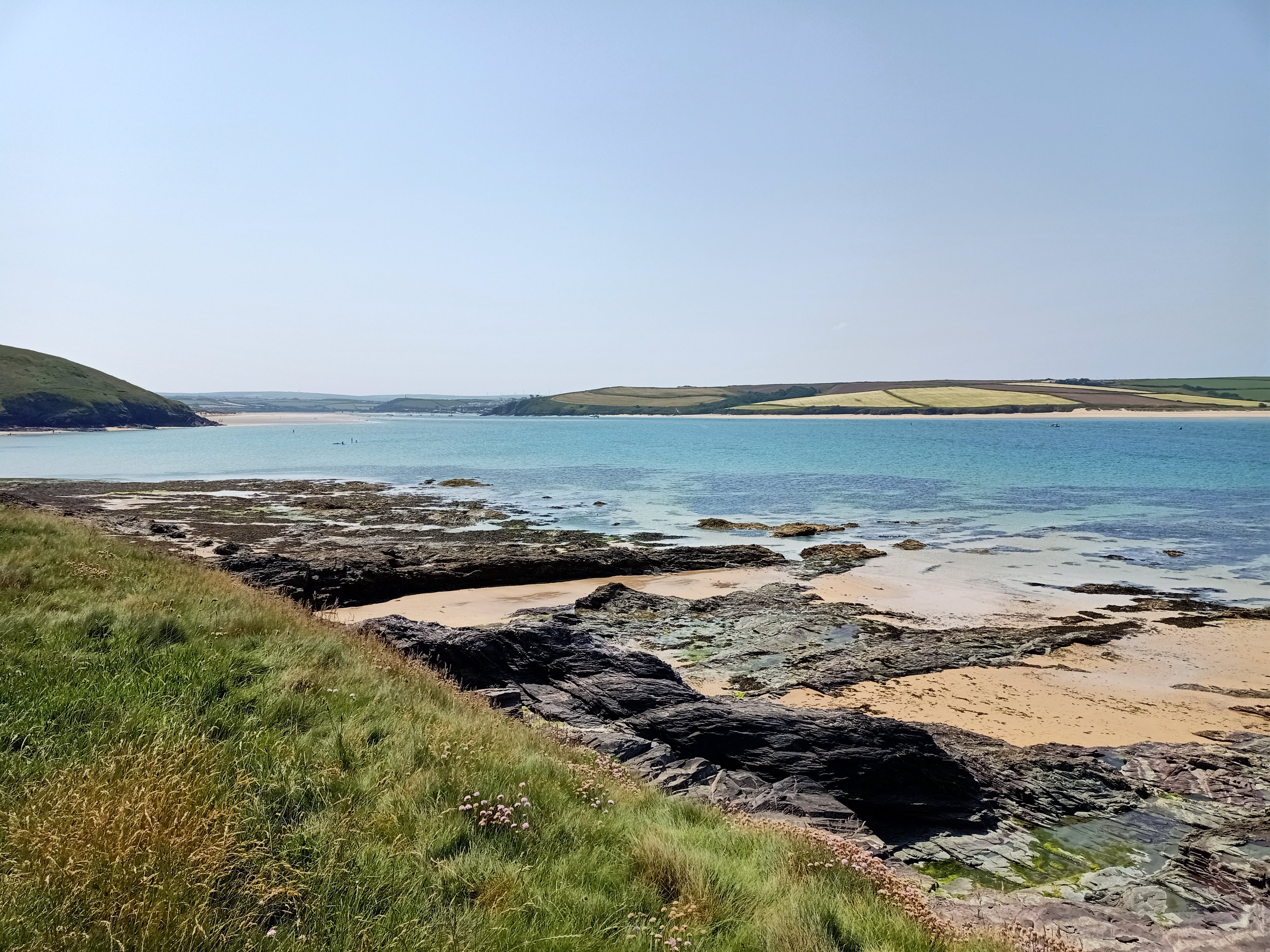
Daymer Bay
While strolling from Daymer Bay towards Polzeath, I had my first taste of rock samphire. This succulent plant, a member of the carrot family, was once popular among sailors as it is high in Vitamin C. Today, you’re more likely find it in a specialty Cornish gin like Tarquin’s limited-edition Holborn Dining Room or Loveday’s Falmouth Dry.
Padstow
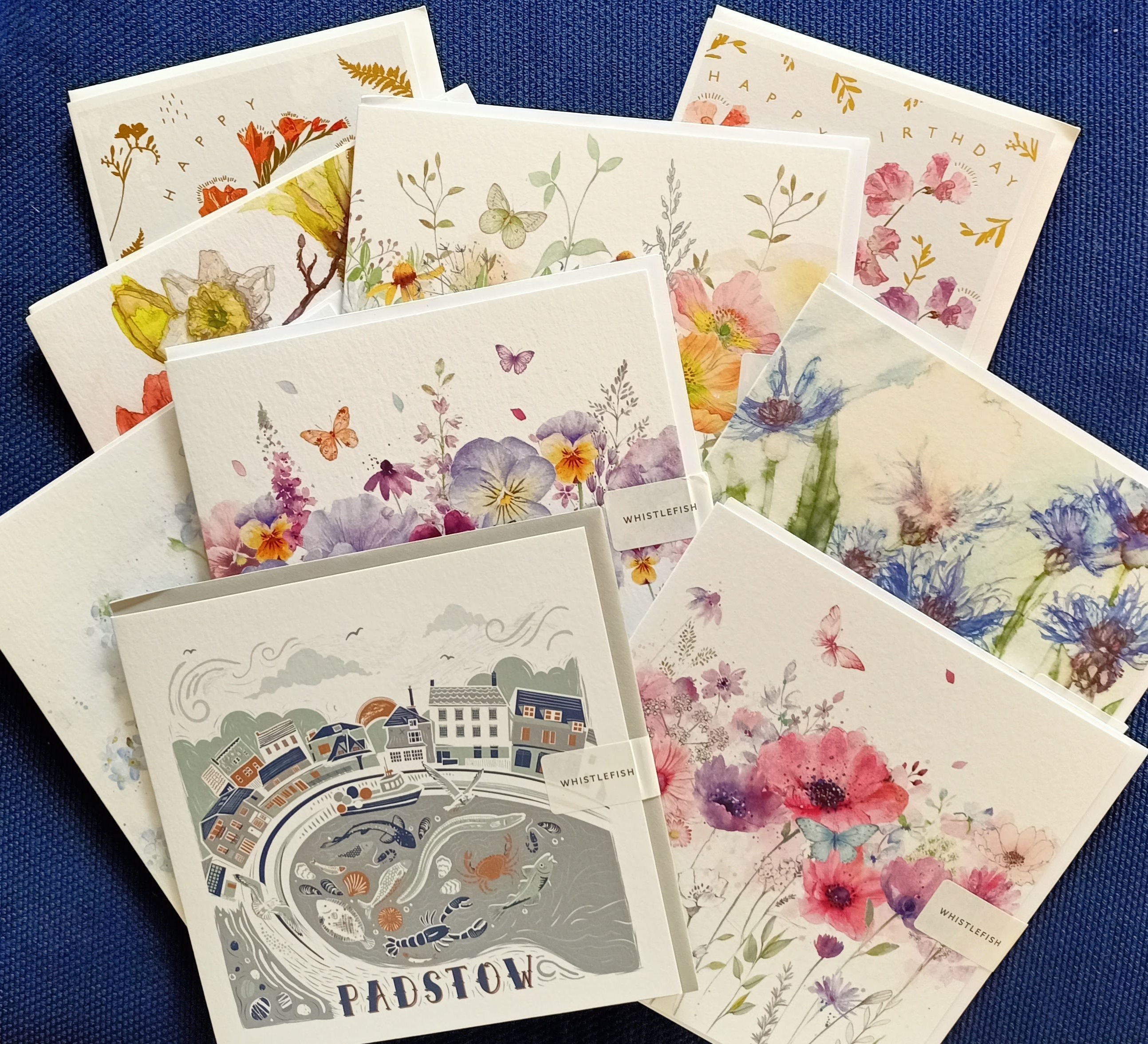
In Padstow, sometimes dubbed ‘Padstein’ due to the proliferation of Rick Stein seafood restaurants, I discovered another ubiquitous Cornish presence – greeting card company Whistlefish. Unaware that there are nine Whistlefish stores dotted around Cornwall (and a further three in Devon), I indulged my penchant for gift cards at my first encounter.
Founded by artist Lyn Thompson, the cards feature the fauna, flora and coastline of Cornwall.
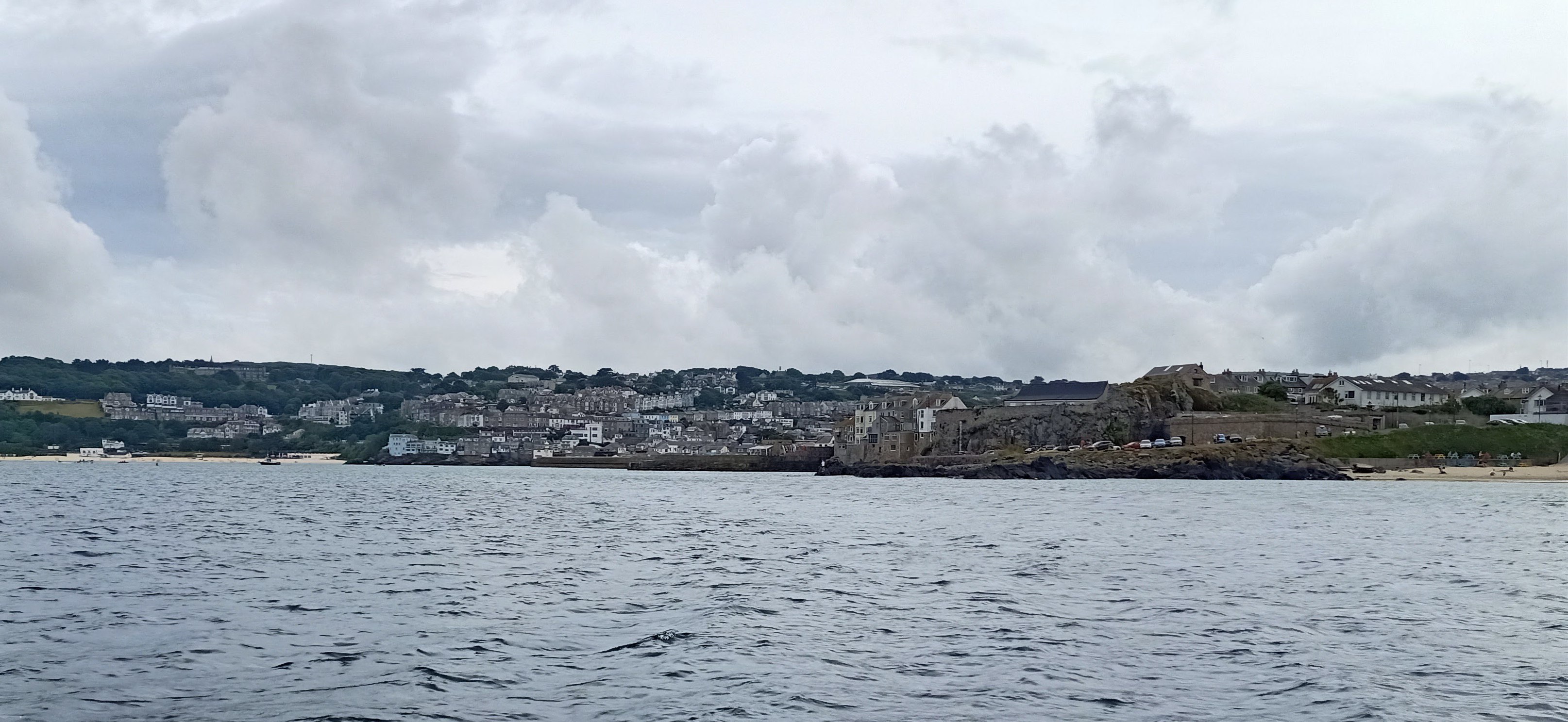
St Ives
Like many places in Cornwall, St Ives is named for a Christian saint. In this case, St Ia (or Eia).
Medieval legend would have it that Ia floated from Ireland to Cornwall on a leaf, but a more credible theory is espoused by Dr Caitlin Green who suggests Ia could have been ‘a Byzantine saint whose cult arrived in south-western Britain in the fifth or sixth century’.
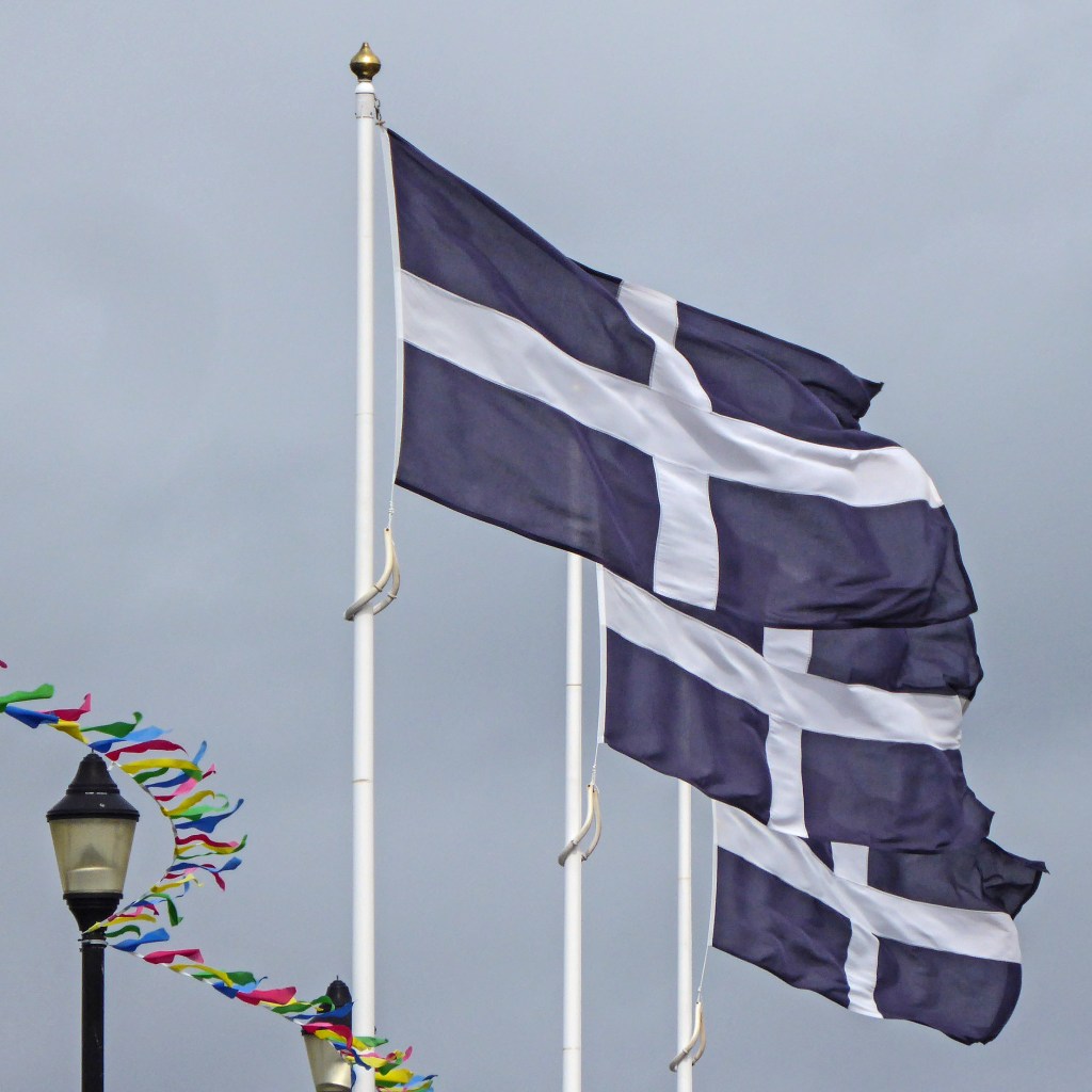
Also mythically floating ashore in Cornwall was St Piran. He is described by the Cornwall Heritage Trust as ‘the merriest, hardest drinking, hardest living holy man Cornwall ever knew’.
In addition to enjoying a good night out, Piran became the patron saint of tin miners, a connection that may explain the Cornish flag. The flag’s white cross on a black background could symbolise both God’s light in the darkness and the shimmering light of tin against subterranean rock.
‘Three St Piran’s Flags’ (at right) by Tim Green from Bradford, UK, CC BY 2.0, via Wikimedia Commons
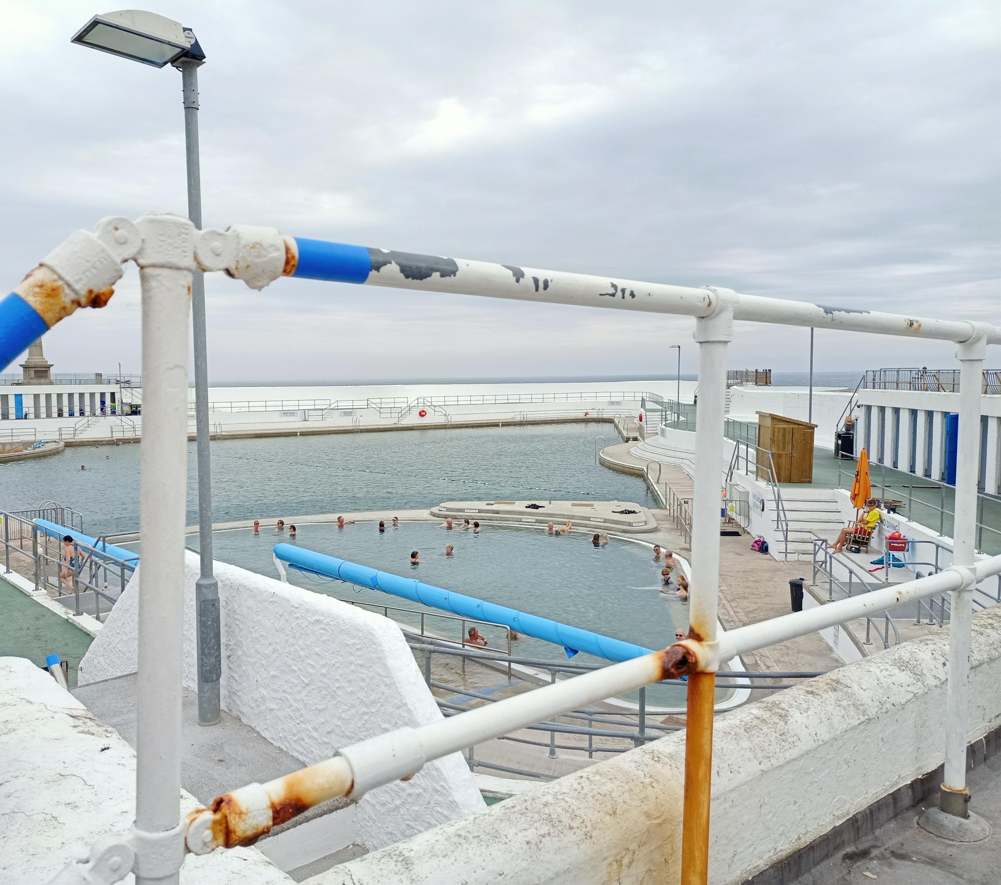
Penzance
Although many Cornish towns and villages are named for saints, many more place names give a clue to topography. The ‘Pen’ in Penzance is the Cornish word for ‘head’ or ‘end’, in this case a headland.
Other prefixes that crop up regularly are ‘Porth’ meaning cove or harbour (Porthscatho – cove of boats); ‘Pol’ also meaning cove, or pool, (Polzeath – dry creek); and ‘Tre’ meaning homestead or a group of dwellings (Tregony – dwellings on the common). (For more information, see John Bannister’s 19th century A Glossary of Cornish Names or P A S Pool’s An Introduction to Cornish Place Names.)
Land’s End
On a mild summer’s day, Land’s End, at the western tip of Cornwall, is a popular place. Cars and tour buses pour onto the site, and commercial and entertainment offerings flaunt their wares. Even the iconic signpost (pointing to New York in the west and John O’Groats to the north) is a fenced-off business proposition – personalised photographs available … for a fee.
If you simply want to gaze out towards the Isles of Scilly, a spot on the rocks, just off the South West Coast Path, is free.

(A permanent sign at this point offers visitors a local weather forecast: ‘If you can see the Scillies, it’s going to rain. If you can’t see them, it is raining.’)

The Land’s End Coaster is an excellent way to reach this destination. The bus runs regularly in both clockwise and anti-clockwise directions, and enables travellers to hop on and off at various south-west Cornwall locations.
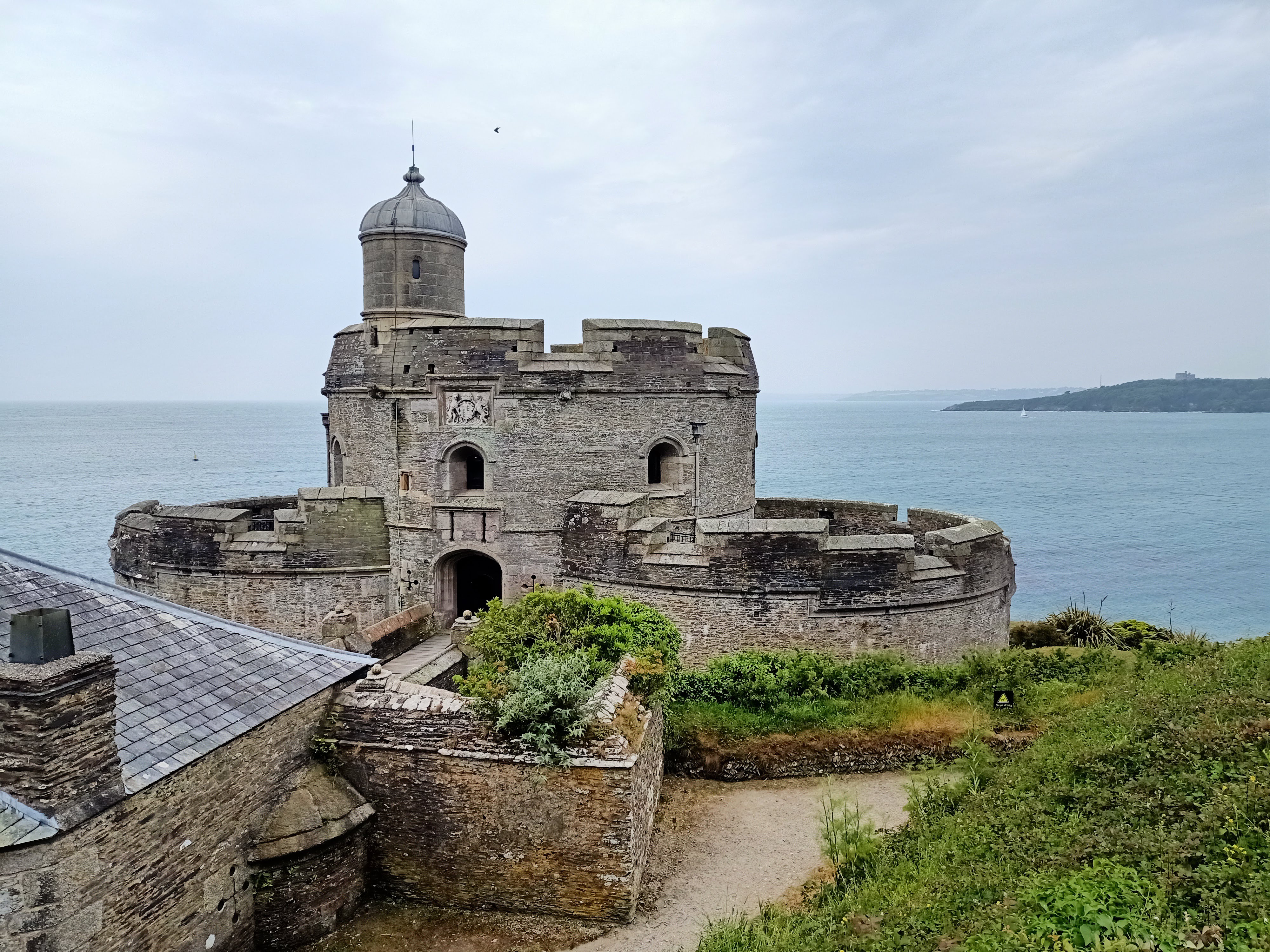
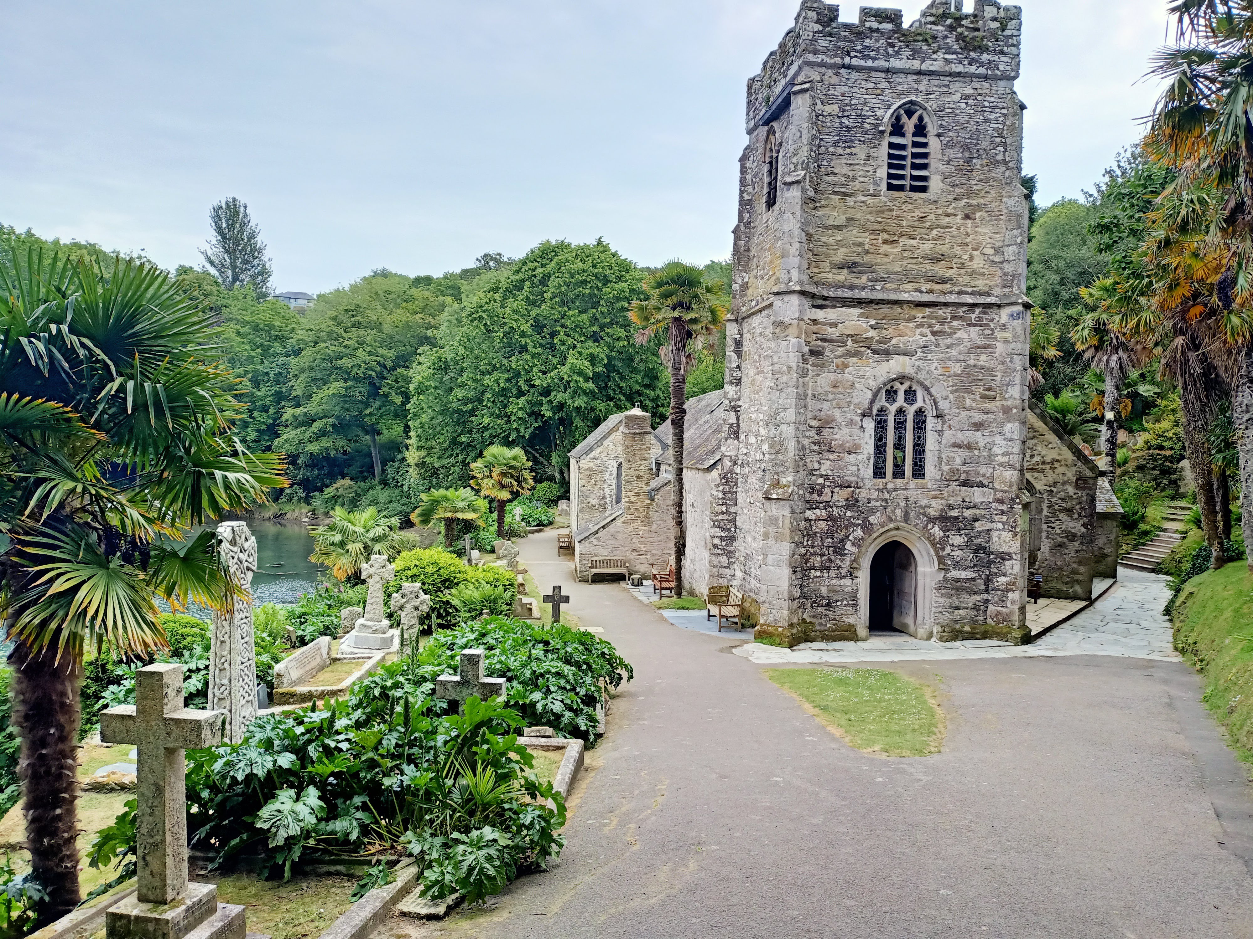
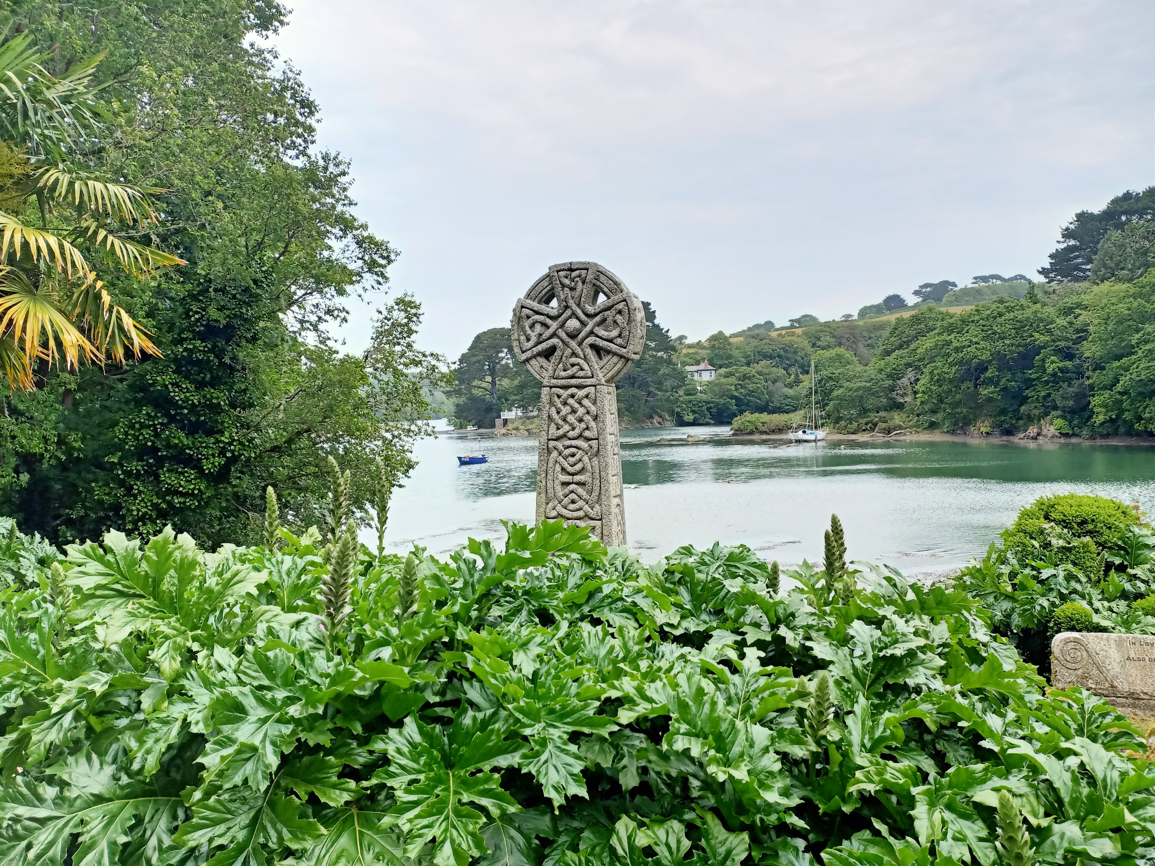
St Mawes and the Church of St Just-in-Roseland
The village of St Mawes is protected by a fortress, commissioned by Henry VIII, one of several fortresses ‘built between 1539 and 1545 to counter an invasion threat from Catholic France and Spain’ (English Heritage).
Venture 4 km up the estuary from St Mawes and you’ll reach a different kind of protected site – the 13th century church of St Just-in-Roseland. Tucked into a valley, the church’s sub-tropical gardens offer a haven to those who navigate its steep descent. In his 1964 book Cornwall: A Shell Guide, English Poet Laureate Sir John Betjeman declared that ‘to many people’, the grounds constitute ‘the most beautiful churchyard on earth’.
Portscatho and Porthcurnick Beach
My main ambition during my Cornwall holiday was to sample a range of Cornish pasties.
The pasty’s Cornish association lies predominantly with the tin mining industry. Vegetables, and sometimes meat, were encased in a thick wrap of pastry, offering portable nourishment to Cornwall’s miners. The pasty’s crimped edge provided a handle for use while eating. (According to the Cornish Pasty Association, ‘if it’s not crimped, it’s not Cornish’.) It is thought the ‘handle’ would have been thrown away at the end of the meal as the miners’ hands could be coated with arsenic.
The best pasty I consumed was from The Hidden Hut, an unpretentious café on Porthcurnick Beach. Approaching along the South West Coast Path from Portscatho, the café is entirely hidden from sight.
I trusted my guide, Louise West of Experience Cornwall Tours, to lead me there. My faith was not ill-founded. The café, together with its beach-setting, is a real gem.

Louise also introduced me to the production of sweet pasties. Traditionally, some miners would eat half-and-half pasties; one end would be savoury and the other sweet. This ‘half-and-half’ idea seems to have disappeared from contemporary Cornish bakeries. It’s all or nothing for a sweet pasty nowadays, for example, the apple, rhubarb and custard pasty at left.
Charlestown
The harbour town now known as Charlestown was originally the tiny fishing settlement of West Polmear but, in the late 18th century, entrepreneur Charles Rashleigh needed a port from which to export copper and china clay. His money built the expanded harbour, and the town now bears his name.
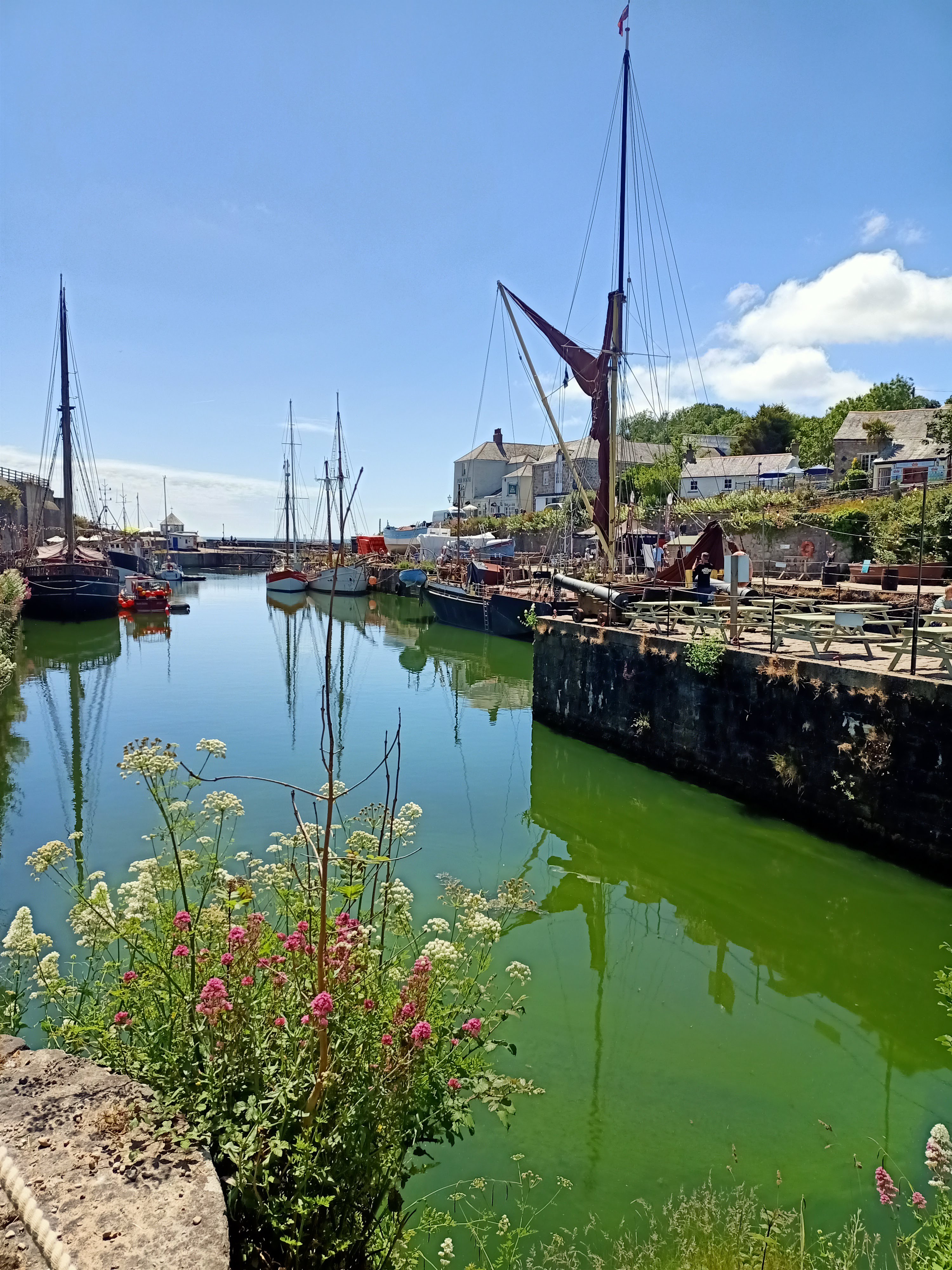
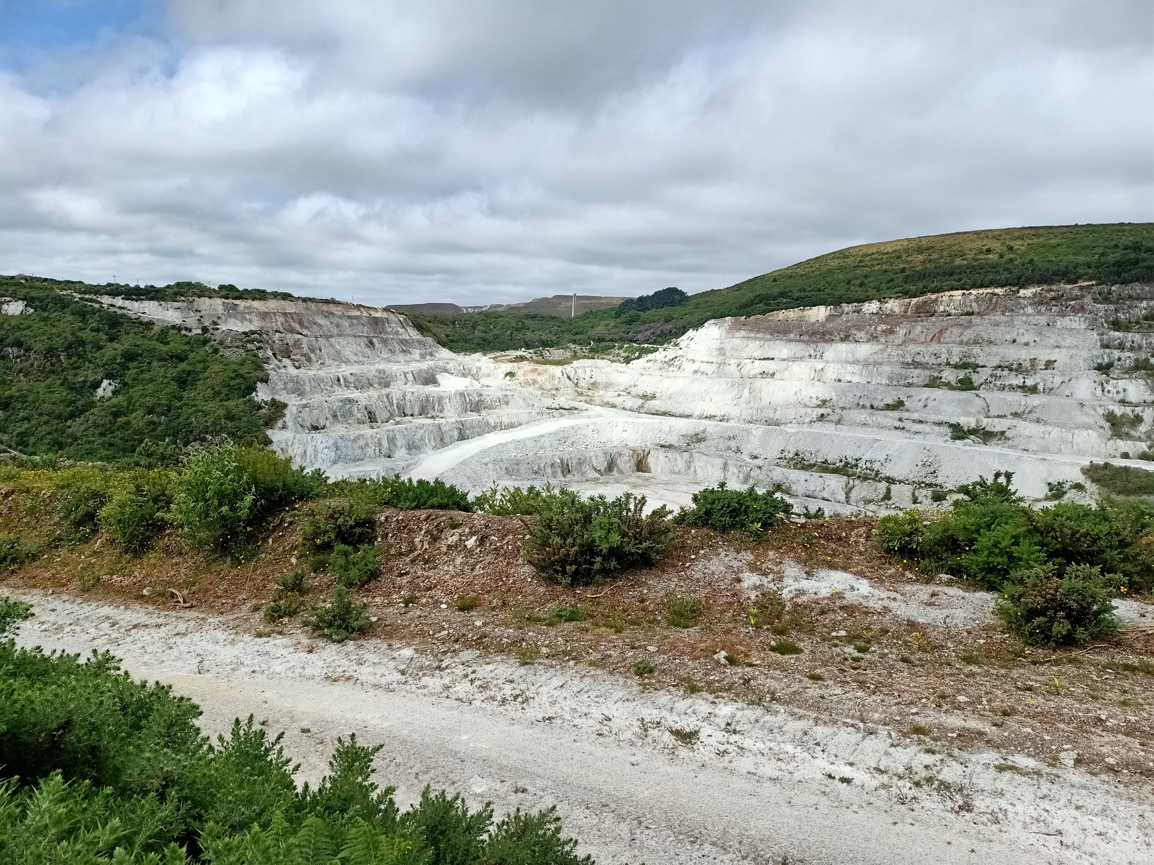
Charlestown is part of UNESCO’s Cornwall and West Devon Mining Landscape World Heritage Site. There is a wealth of information on this dispersed site on the website for Cornish Mining World Heritage.
An area centre for the World Heritage site is located at nearby Wheal Martyn where the still-active quarry produces about 2,000 tons of clay per week.
Links and sources
- South West Coast Path
- Whistlefish
- ‘St Ia of St Ives: a Byzantine saint in early medieval Cornwall?’ by Dr Caitlin Green
- ‘Saint Piran’, Cornwall Heritage Trust
- A Glossary of Cornish Names by John Bannister
- An Introduction to Cornish Place Names by P A S Pool
- Jubilee Pool, Penzance
- Land’s End Coaster
- ‘Heritage Church: St Just in Roseland’ by Alison Johnson, This England, 3 February 2021(via PressReader)
- Cornish Pasty Association
- The Hidden Hut, Porthcurnick Beach
- Cornish Mining World Heritage
- Wheal Martyn Clay Works.
With thanks…
During my two weeks in Cornwall:
- I spent three days with Louise West of Experience Cornwall Tours. Louise’s local knowledge (and navigating and parking skills) are exemplary.
- I caught sundry Kernow buses utilising the company’s print timetable, their online journey planner and their very handy app.
- In Truro, I stayed at Cliftons Bed & Breakfast; in St Ives my base, via Airbnb, was The Old Bookshop.
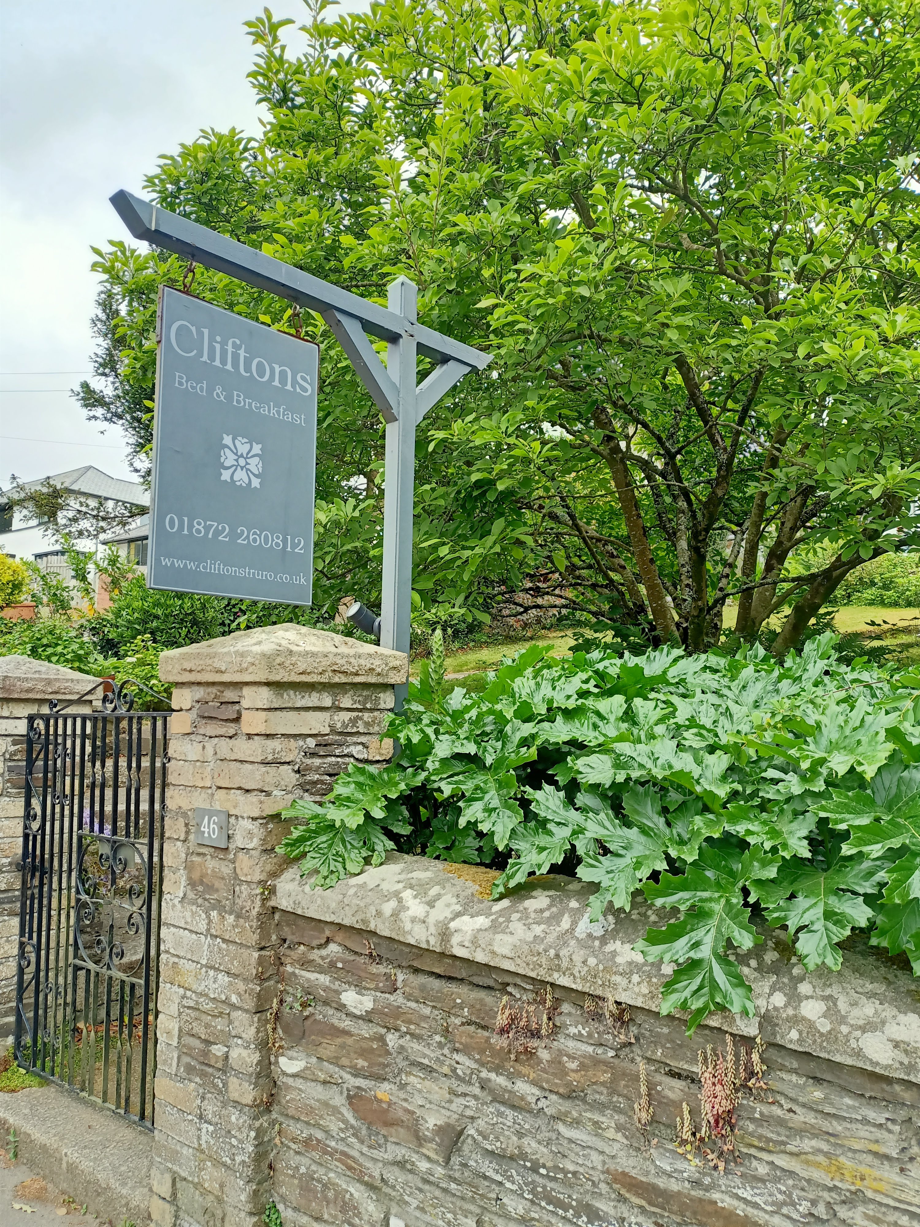
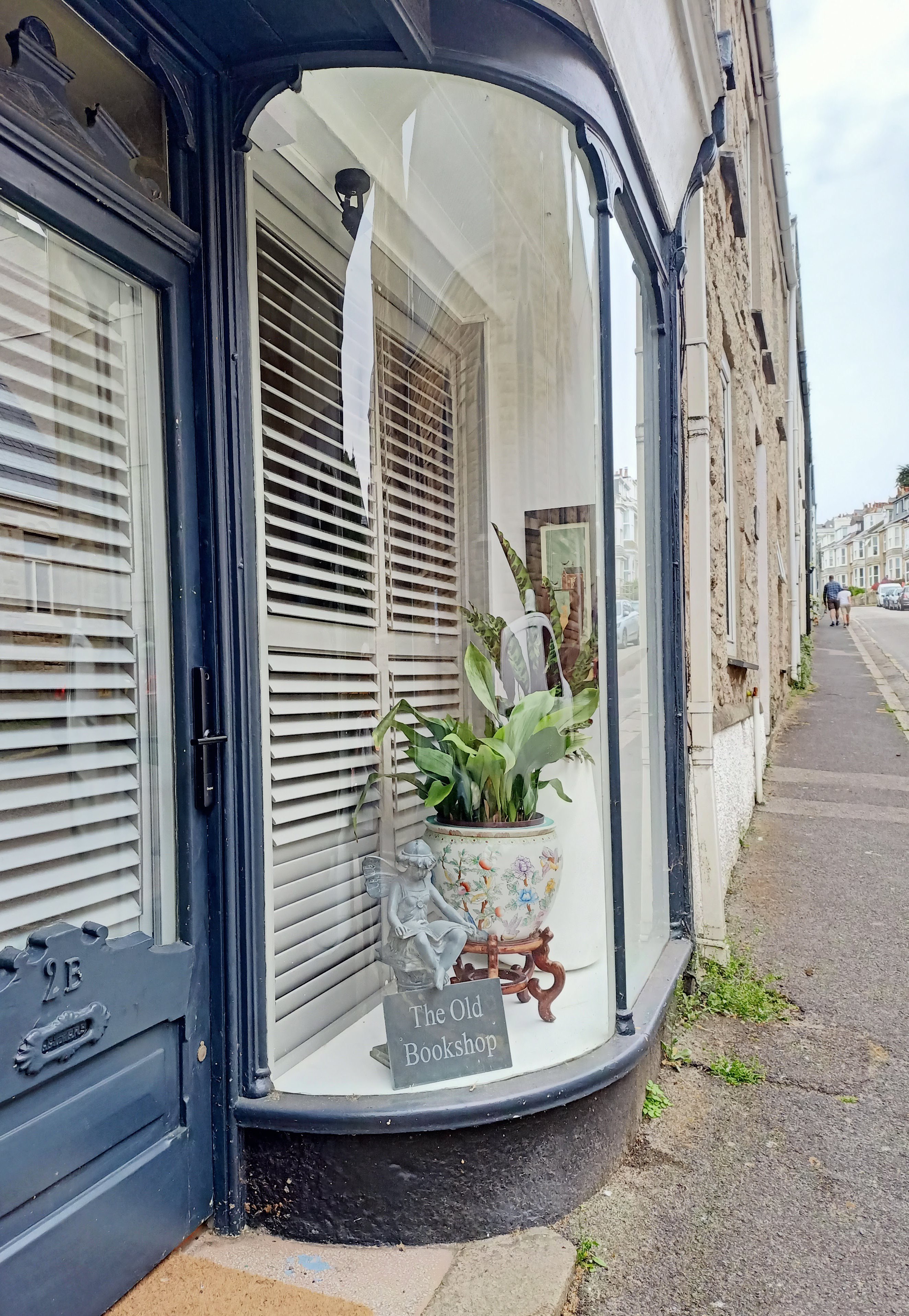
Photo credits
- Photograph of ‘Three St Piran’s Flags’ by Tim Green from Bradford, UK, CC BY 2.0 via Wiki Commons.
- All other photos by the author. This blog is licensed under a Creative Commons Attribution-NonCommercial-NoDerivatives 4.0 International License. Photos are free to use and share, but please attribute and link back to the blog.
- Featured image: St Austell Bay, taken from Charlestown.
Map


Leave a reply to Leonie Foster Cancel reply